

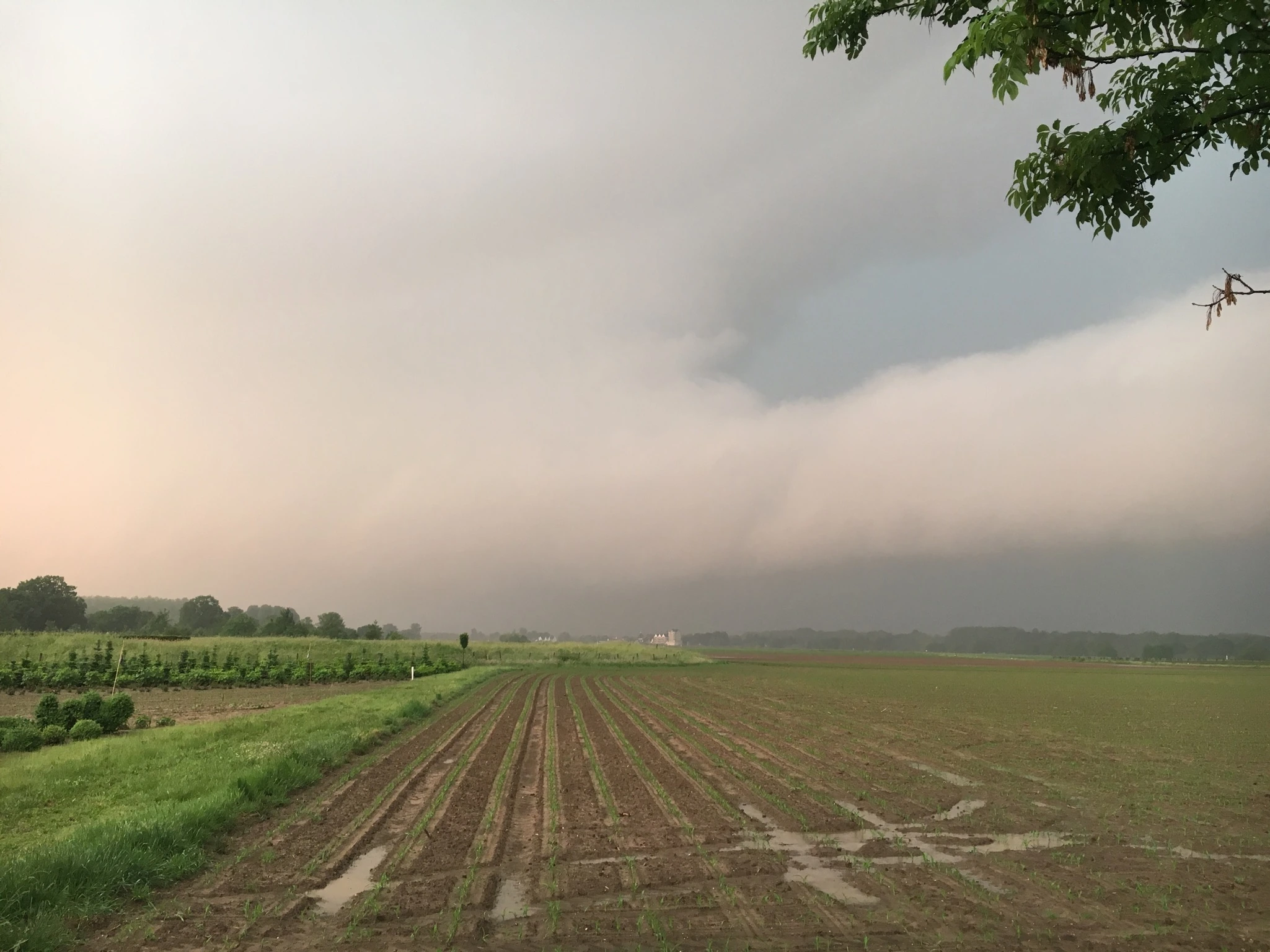
A thunderstorm does not need to produce a tornado to bring down trees or damage roofs. A powerful rush of air from above can do that too. When it reaches the ground, it spreads sideways. These violent downdrafts and their outflow winds are called downbursts.
They can hit a small town while barely affecting places just a few kilometres away. In larger thunderstorm systems, damage can extend over much greater distances. Both happen in western Europe. What matters is how the downdraft develops and what the air does when it reaches the ground.
Updated: 8 November 2026. Weather explained; not a forecast of a current severe-weather situation.
How rain and cold air can produce a downburst
Inside a thunderstorm, air moves both upwards and downwards. Warm, moist air rises. Raindrops, graupel and hailstones grow until they fall. The falling precipitation drags air down with it and adds weight to the updraft.
Cooling also plays a part. As some of the drops evaporate, they take heat from the air. Melting ice contributes too. This can be particularly effective when dry air enters the precipitation area. If the cooled air is denser than its surroundings, it sinks more strongly. The strength of the downdraft also depends on the temperature profile and the flow within the storm. This is how the US National Weather Service explains the process.
At the ground, the air cannot keep moving downwards. It spreads sideways instead. The downdraft becomes a powerful outflow close to the surface. It is called a downburst when this produces particularly strong winds. Not every rain shower or thunderstorm downdraft reaches that intensity. Definition from Germany's national weather service, DWD.
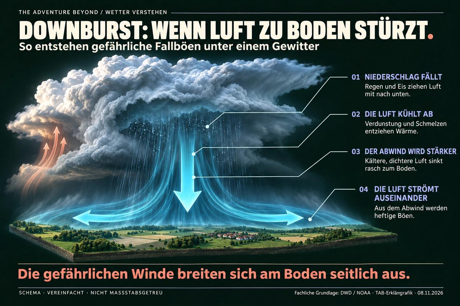
Diagram explained in words
A thunderstorm cloud is shown at the top. Precipitation falls inside and below it. Evaporating water and melting ice remove heat from the air. The cooled air can become denser than its surroundings and accelerate downwards. On reaching the ground, it spreads outwards. The reddish arrows on the left show a separate updraft. Sizes, distances and airflows are simplified; this is not a depiction of a particular storm.
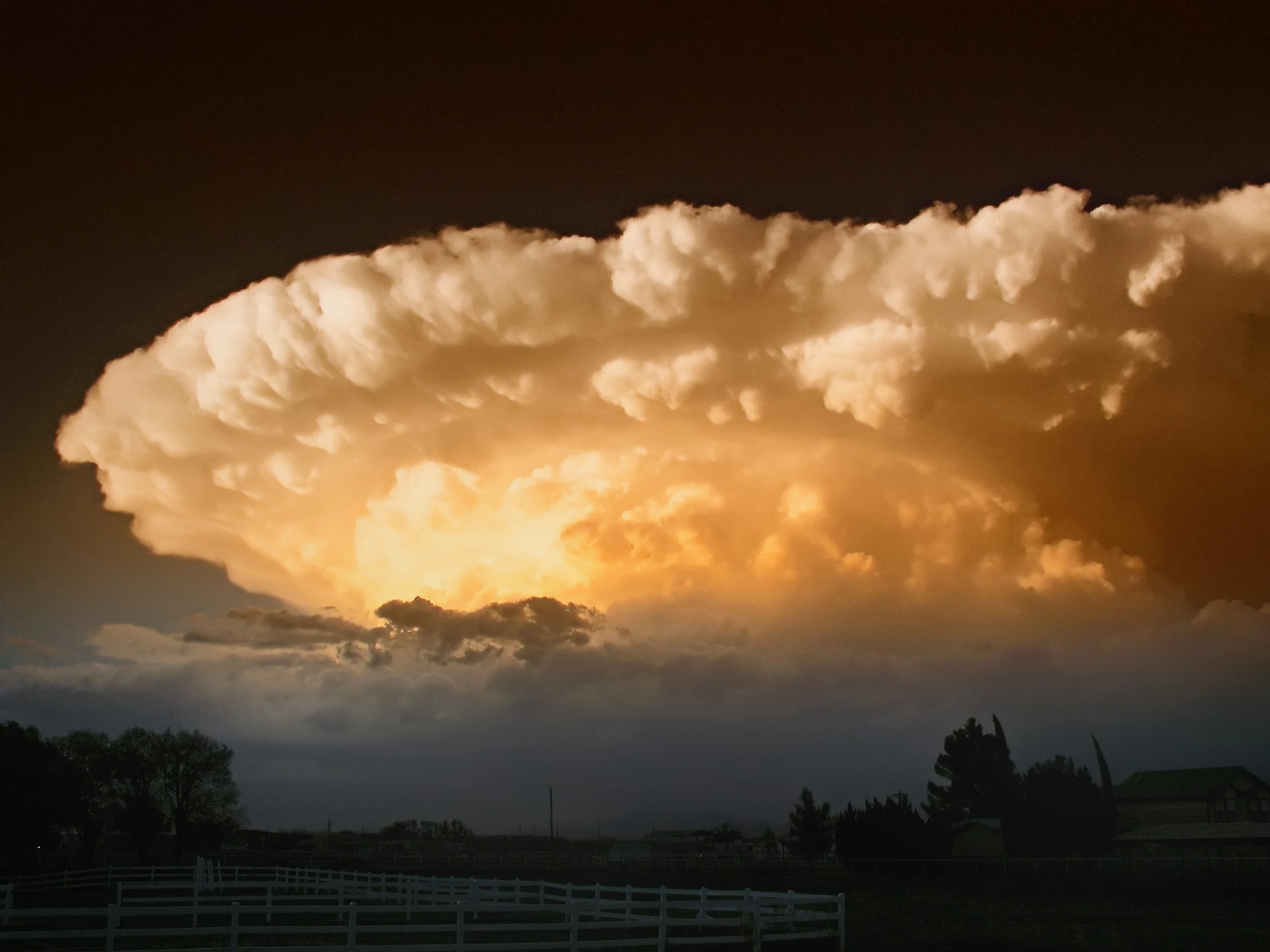
Heavy rain is possible, but not essential
In a wet downburst, a large amount of precipitation reaches the ground. Rain or hail can become so dense that visibility almost disappears. In a dry downburst, much of the precipitation evaporates before reaching the surface. Little rain reaches the ground, but the wind can still be dangerous. A 2026 scientific paper describes both types.
The terms microburst and macroburst describe the size of the wind field near the ground. Up to roughly four kilometres across, it is called a microburst; larger events are macrobursts. This is not a wind-speed scale. Even a small event can cause severe damage. DWD: classification by size.
How one thunderstorm can trigger new cells
The cold air that has flowed out initially stays close to the ground. Meteorologists call this a cold pool. Its leading edge slides beneath the warmer surrounding air and lifts it. Under suitable conditions, a new updraft can develop there, followed by another thunderstorm cell.
Several cells can interact in this way and form a longer-lasting line of thunderstorms. A derecho is a particularly long-lived, widespread convective wind event that causes damage across a large area. The term therefore means more than a single powerful downburst. Not every squall line is a derecho. A European study puts these systems into context.
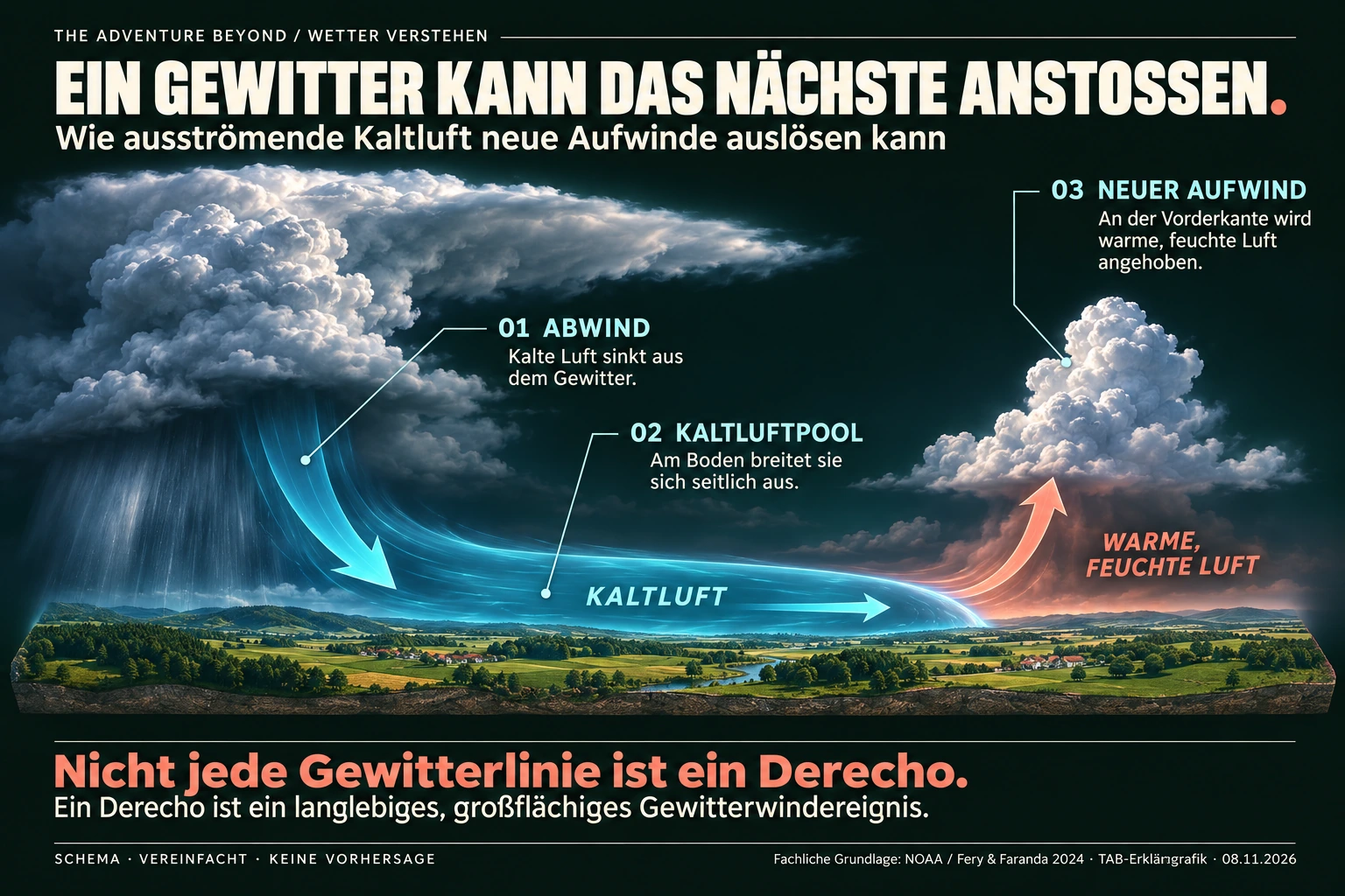
Diagram explained in words
On the left, a downdraft feeds a shallow layer of cold air near the ground. It flows to the right and slides beneath the warm, moist surrounding air. Warm air rises at the leading edge. With a suitable atmospheric profile, a new storm cell can grow there. Not every cold pool produces new thunderstorms, and not every squall line meets the criteria for a derecho.
The damage downbursts leave behind
Typical damage includes uprooted or snapped trees, damaged roofs, torn-off cladding and broken power lines. The strongest winds can arrive before the rain. Waiting for the first drops before taking action may therefore be too late. KNMI: winds at the edge of a thunderstorm.
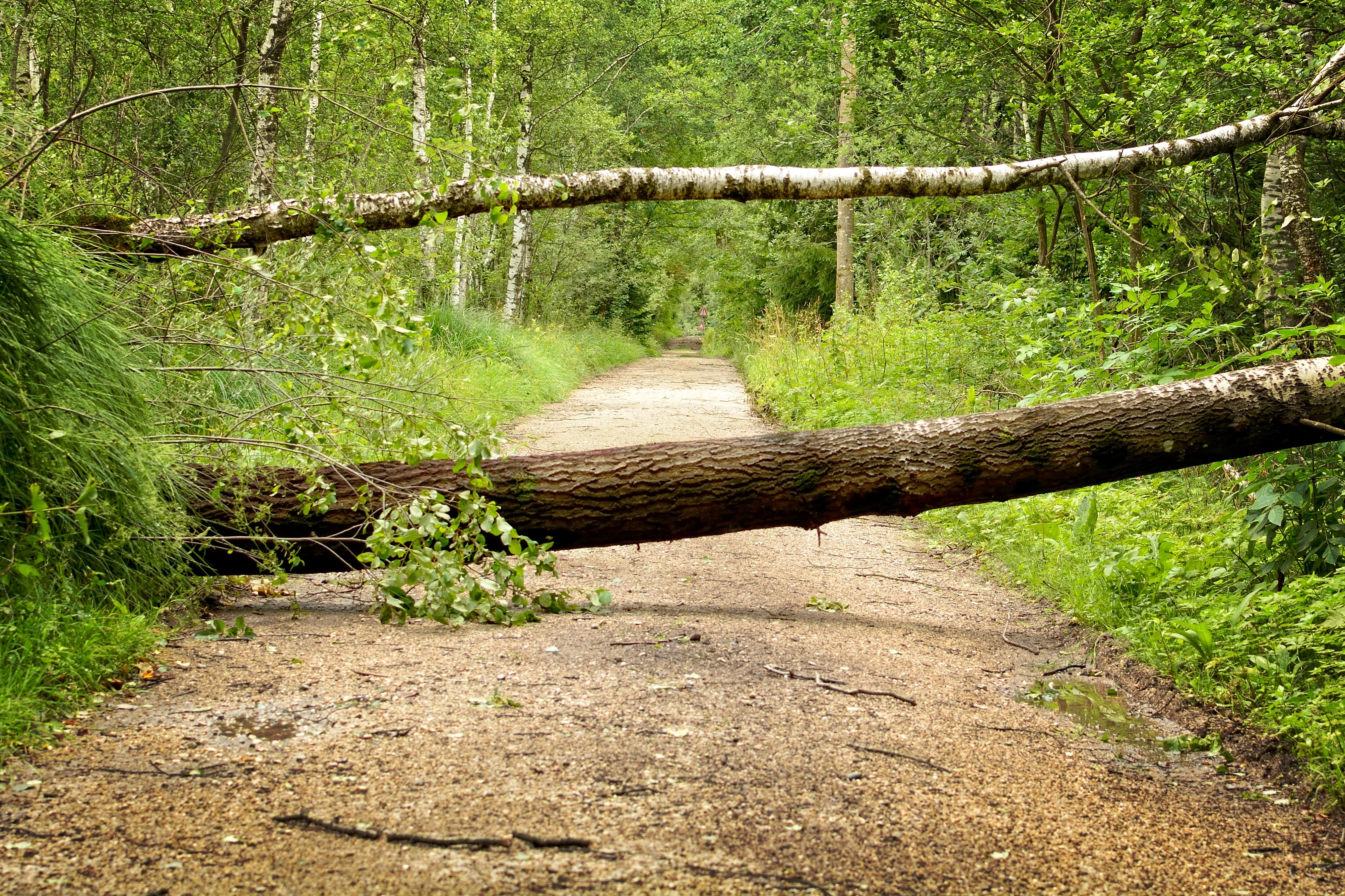
Across large parts of a damaged area, trees often lie in a similar direction. Elsewhere, the pattern may fan out. This is consistent with an outflowing air mass. Terrain, buildings and smaller vortices can alter the pattern, however. Even in a downburst, not every gust travels in a perfectly straight line.
A tornado is a rotating column of air extending from a shower or thunderstorm cloud to the ground. Its visible condensation funnel does not have to reach the surface. NOAA/NWS explicitly makes this distinction. A tornado's damage track is often narrower, and the direction in which trees fall may vary more. A photograph alone still cannot reliably distinguish the two. Specialists examine the whole damage area and compare it with radar, measurements and video. KNMI explains the distinction using the Leersum event.
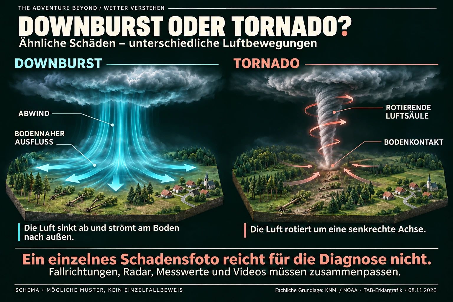
Diagram explained in words
The left half shows a broad downdraft and arrows pointing outwards near the ground. The right half shows a narrow vortex rotating around a vertical axis and connecting the cloud to the ground. Fallen trees illustrate possible damage patterns. In reality, terrain, buildings and local vortices can change the direction of falling trees. A wider damage area, radar, wind measurements and, where available, video need to be assessed together.
For buildings, the way wind is deflected around corners, roofs and neighbouring structures also matters. This can create strong pressure and suction on individual surfaces. Flying debris causes additional damage. Tests on building models show why the highest recorded wind speed alone does not explain the damage. A team at Florida International University describes these effects.
What this means for western Europe
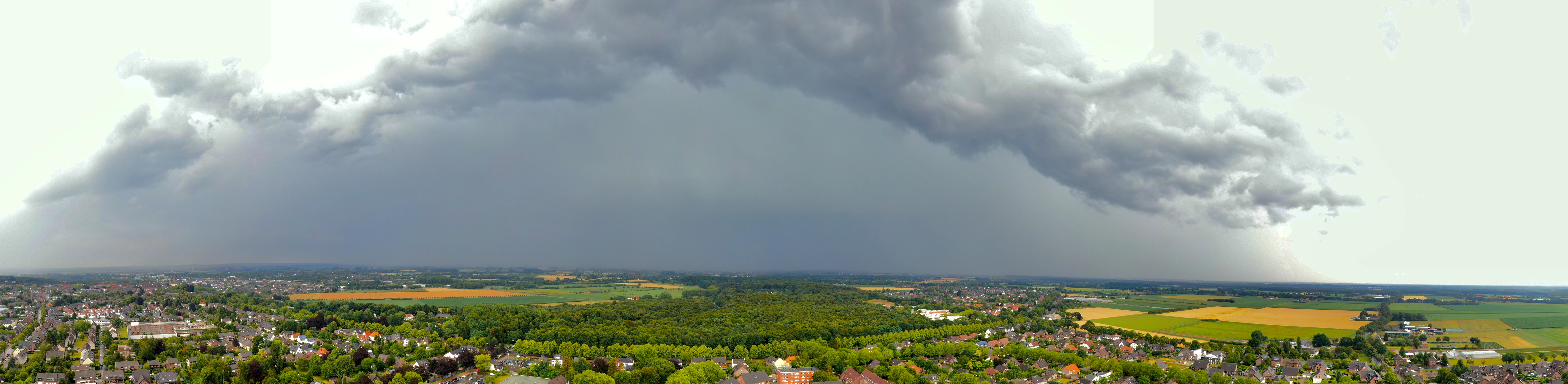
Downbursts are not new here. On 18 June 2021, Leersum in the Netherlands was badly hit. KNMI's investigation identified a downburst as the cause. The case shows why severe storm damage after a thunderstorm should not automatically be attributed to a tornado. KNMI, 21 June 2021.
The derecho of 18 August 2022 was on a very different scale. It crossed Corsica, northern Italy and the Alps, continuing north-eastwards. Gusts of up to 225 km/h were measured on Corsica. This was an extensive thunderstorm system with severe downbursts, not one giant downburst. Fery and Faranda, 2024.
The same study identified 38 warm-season derechos in France between 2000 and 2022. The north-east and east were particularly affected; these weather patterns can also involve the Benelux countries, Germany and Switzerland. That figure describes the selected events in France. It neither counts all European downbursts nor demonstrates an increase on its own.
What researchers are now investigating in more detail
A paper published in March 2026 presents measurements from a wind tunnel in Nantes. The experiments used different temperatures for the descending and surrounding air. This makes it possible to test how denser cold air changes the outflow and vortices near the ground. The data help improve models of wind loads on structures. Such an experiment reproduces only part of a real thunderstorm. Canepa and colleagues: CLIMATHUNDERR.
Researchers also want to improve early warning. Since July 2026, EUMETSAT has been releasing preliminary data from the new infrared sounder on MTG-S1. These should provide a better picture of temperature and humidity at different heights and help identify unstable air. They complement radar and surface measurements. They do not guarantee an exact prediction of where and when every individual downburst will occur. EUMETSAT on the current stage of development.
Is climate change making downbursts stronger?
At higher temperatures, air can contain more water vapour before becoming saturated. With enough moisture and suitable triggers, this can favour powerful thunderstorms and heavier precipitation. Dry layers, wind conditions and the organisation of the storm also matter for downbursts.
A 2023 study by Andreas Prein finds an intensification of non-tornadic thunderstorm winds in the central USA. That is an important finding, but not a percentage forecast for the Lower Rhine. The 2024 French study finds more available thunderstorm energy under comparable weather patterns, but no consistent change in the wind shear examined. It cannot rule out the influence of natural climate variability. Prein 2023, abstract; Fery and Faranda 2024.
Regional changes in the frequency and strength of individual downbursts in western Europe cannot yet be reliably quantified everywhere. Damage can also rise because more buildings and other assets lie in the path of storms. Better reporting brings more events to light too. Comparisons over longer periods need to account for this.
For us, the practical point is simple: when a thunderstorm warning is issued, the forecast gusts are as much a hazard as lightning, hail and heavy rain. A place that is still dry is not necessarily outside the wind field. Outdoors, on campsites or beneath trees, the gust front can arrive before the visible rain. KNMI: sudden strengthening of the wind ahead of the rain front.
Sources and background
The ARTE documentary “Downbursts – In the Focus of Research” released on 1 November 2026 shows how researchers measure these winds and recreate them in wind tunnels. The following sources provide more detail on the explanation and the European examples.
- ARTE: Downbursts – In the Focus of Research
- DWD: Downburst
- NOAA/NWS: How Do Downbursts Form?
- KNMI: Downbursts
- KNMI: Leersum, 18 June 2021
- NOAA/NWS: tornadoes and visible condensation funnels
- Fery & Faranda 2024: derechos in France
- Prein 2023: thunderstorm winds in the central USA
- Canepa and colleagues 2026: CLIMATHUNDERR
- Florida International University 2025: downbursts and buildings
- EUMETSAT, 30 July 2026: new infrared data
Image note: the title illustration and explanatory diagrams were created with AI and checked against the underlying principles shown. They are simplified schematics, not measurements or photographs of a real severe-weather event. Full text descriptions are also provided beneath the diagrams.