
 ← All stories
STORM FILE · Stormchasing
A thunderstorm can rotate strongly without producing a tornado. The broad rotation in the cloud and the narrow vortex at the ground are connected, but they are not the same thing. For a tornado to form, the flow just above the ground must become tightly concentrated and connect to the cloud.
Diesen Beitrag anhören
Dauer: 14 Minuten 30 Sekunden
MP3 herunterladen · 10,4 MBStimme und Quelle
Thorsten-Voice / Piper. Sprecher Thorsten Müller. Stimmaufnahmen unter CC0. Thorsten-Voice.
Listen to this article
Duration: 13 minutes 27 seconds
Download MP3 · 9.7 MBVoice credits
Alba / Piper. Alba speech corpus (2019), Cassia Valentini-Botinhao and Junichi Yamagishi, University of Edinburgh. Voice recordings licensed under CC BY 4.0 and used to train a synthetic voice. The article is by The Adventure Beyond.
Beluister dit artikel
Duur: 16 minuten en 55 seconden
MP3 downloaden · 12,2 MBStem en bron
Ronnie / Piper. Stemopnamen van OHF-Voice, beschikbaar onder CC0. Stemgegevens en bron.
A cloud photo tells us little about what happens at ground level. What matters is how the air converges, what rotation it carries and how it enters the updraft. Newer measurements and simulations show that tornadoes can develop by different routes.
01 / FIELD NOTE
What we mean by a tornado
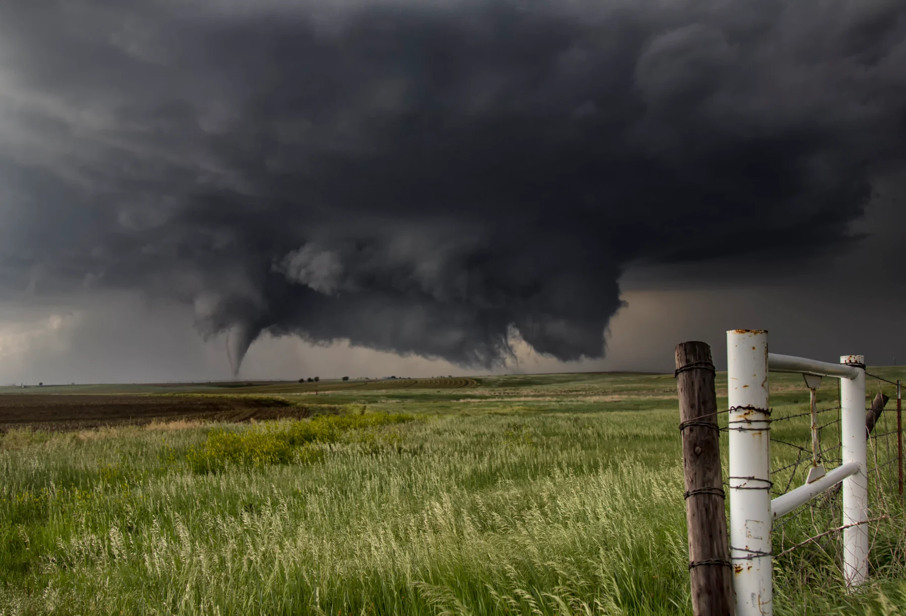
A tornado is a violently rotating column of air extending from a shower or thunderstorm cloud to the ground. It is often visible as a cloud funnel, swirling dust or debris. The funnel does not have to be visible all the way down. A hurricane is different: it is a large tropical weather system over warm ocean water. Tornadoes form within much smaller weather systems. World Meteorological Organization definition; NOAA/NSSL: tornadoes.
02 / FIELD NOTE
The updraft keeps a storm alive
Warm, moist air can fuel a thunderstorm. If it is lifted and the air above is suitably layered, it continues to rise. As it rises, it cools. Water vapour condenses into tiny droplets and the cloud grows. Condensation releases heat, which can support the upward motion. This rising air current is called an updraft.
Thunderstorms also contain sinking air. Rain and hail fall; evaporation can cool the air further. The arrangement of the updraft, downdraft and incoming air influences how the storm develops. The simple idea that “warm air meets cold air and a tornado forms” does not explain enough. Met Office: conditions and development.
03 / FIELD NOTE
Why wind changes with height matter
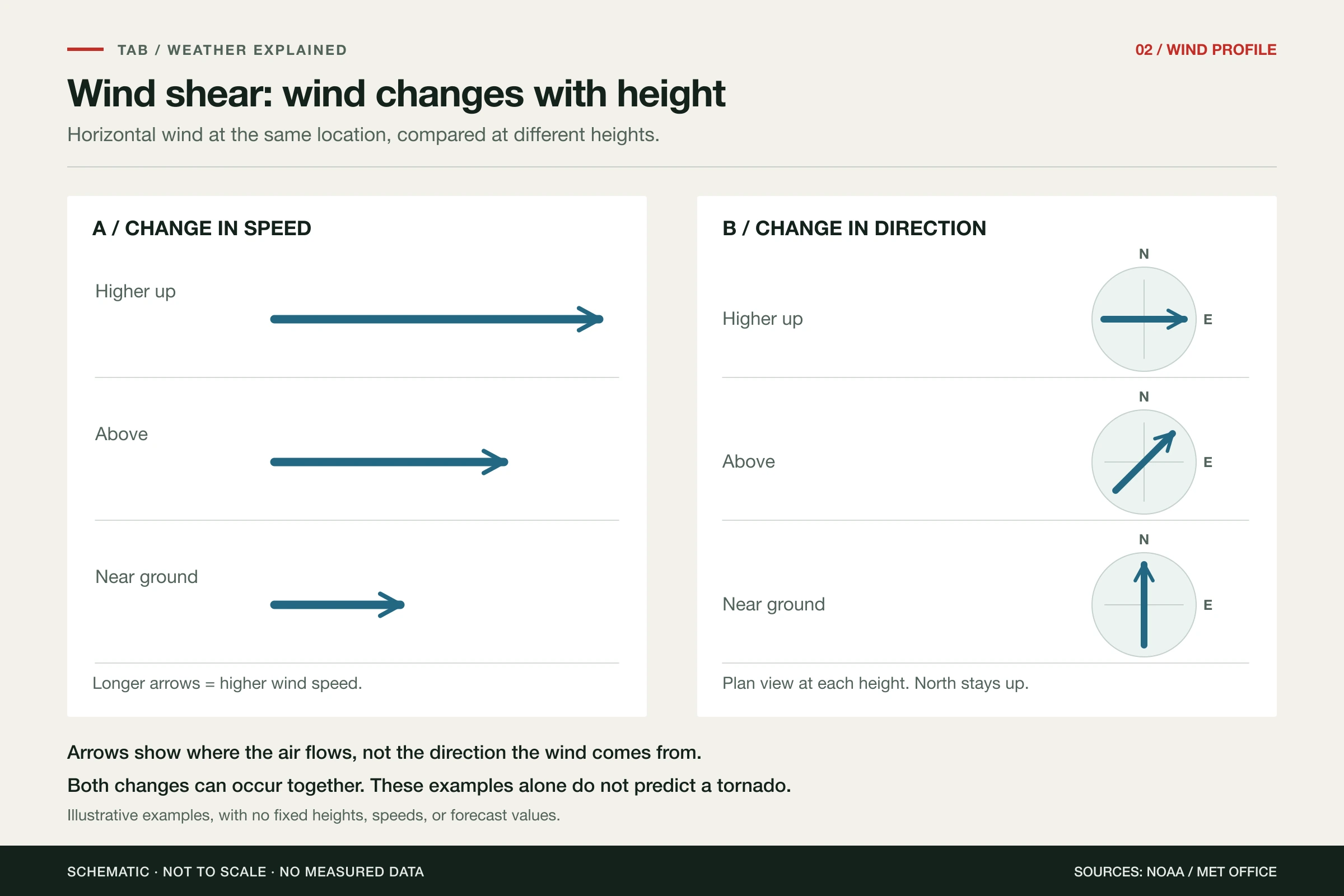
Wind near the ground can differ from wind a few hundred metres or several kilometres above it. It may strengthen, change direction or both. This change with height is called vertical wind shear.
These wind differences mean the air can already contain rotation. A thunderstorm updraft can tilt and strengthen some of it, producing a rotating updraft. The familiar picture of a horizontal roll of air being tilted upwards illustrates this step. It does not yet explain how a tornado forms at the ground. NOAA/NSSL: wind shear and rotating thunderstorms.
04 / FIELD NOTE
The supercell rotates; a tornado is another step
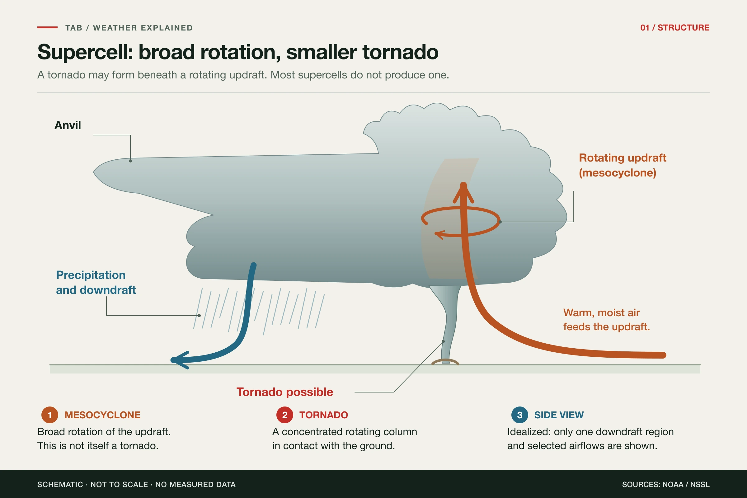
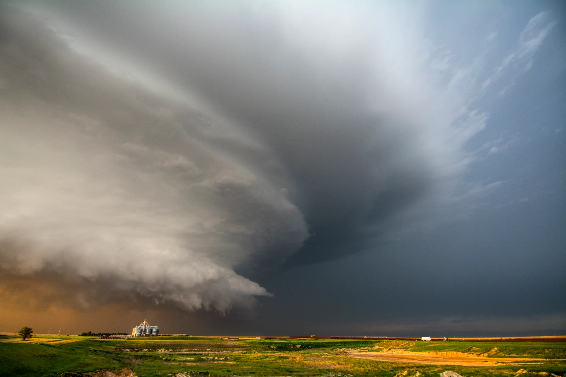
A thunderstorm with a persistent rotating updraft extending through a deep layer is called a supercell. The broad rotation of that updraft is known as a mesocyclone. A tornado can form beneath it, but most supercells do not produce one.
Even without a tornado, a supercell can bring large hail, heavy rain and damaging wind gusts. Its organised airflow allows fresh air to reach the updraft for a long time. Which parts of the cloud are visible and how much rain surrounds the updraft differ from storm to storm. A striking cloud shape alone therefore proves nothing. NOAA/NSSL: structure of a supercell.
05 / FIELD NOTE
The crucial transition happens near the ground
Rotation in the cloud does not simply extend downwards as a ready-made tube. In the lowest layers of air, patches of rotation may initially be scattered and irregular. To form a tornado, they must organise and strengthen into a narrow, connected vortex.
As air converges beneath a strong updraft, rotation can be concentrated into a smaller space and stretched upwards. The rate of rotation can then rise sharply. In a developed tornado, the incoming air turns steeply upwards just above the ground. A 2024 scientific review describes this process in four steps: a rotating thunderstorm updraft, rotation near the ground, its organisation and intensification, and the transition to the flow of a fully developed tornado. This is a model for understanding the process; it cannot predict which individual storm will produce a tornado.
06 / FIELD NOTE
Where does rotation near the ground come from?
Several processes may contribute. Air may already be rotating around the storm. Within the storm, temperature differences and downdrafts can also create or redirect rotation. Interaction with the ground matters too. Their relative contributions differ from case to case.
A 2024 simulation study by Paul Markowski shows this. In the turbulent surrounding air studied, rotating structures were already present near the ground. Beneath the updraft, they could strengthen into a tornado-like vortex. Earlier models often assumed smoother, more uniform surroundings. This result shows another possible route. It does not prove that every real tornado forms this way.
Measurements add to the picture. A 2025 study by Satrio and colleagues tracked a supercell in Nebraska for 96 minutes. Air paths reconstructed from radar data showed contributions to the low-level mesocyclone from both surrounding air and a rain-cooled part of the storm during its most active phase. Temperature differences mattered for some of that air. This was one storm, and the study examined the larger rotation low in the storm. It does not establish a fixed recipe for all tornadoes.
The TORUS research project shows how demanding such measurements are. Its 2026 project overview describes observations of 46 supercells during field campaigns in 2019, 2022 and 2023. Researchers combined mobile radar, measuring vehicles, weather balloons, crewed aircraft and drones. This lets them study wind, temperature and humidity where standard observation networks miss detail. The 2026 publication date does not mean the storms were observed in 2026.
07 / FIELD NOTE
What a new radar study shows, and what remains open
For warnings, a feature that reliably appears shortly before a tornado forms would be useful. A study by Herriott and Tanamachi published on 15 September 2026 examined so-called ZDR columns. These are particular radar signatures that may reveal processes in the updraft.
The researchers compared three observed supercells, two tornadic and one not, with 30 model simulations. On average, the simulations showed changes in the studied features before tornadogenesis. In the three observed storms, however, they found no corresponding changes that consistently distinguished the tornadic storms from the non-tornadic one.
A relationship in a model is not yet a reliable warning signal in practice. The observational sample is small; it disproves neither the value of radar nor the importance of the updraft. It shows why new approaches need testing in more real storms.
08 / FIELD NOTE
The visible funnel does not show the whole vortex
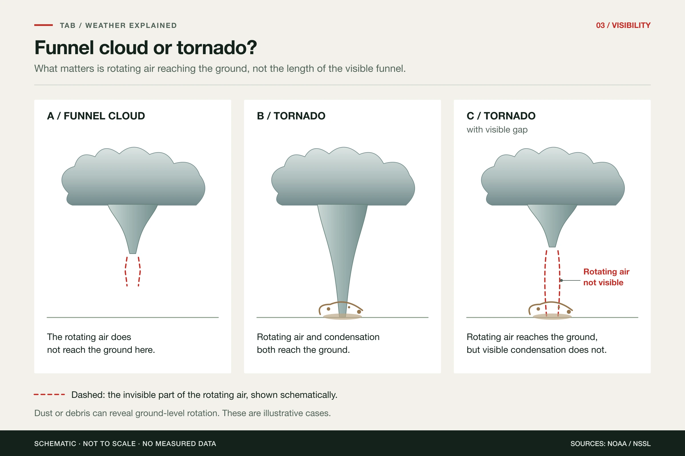
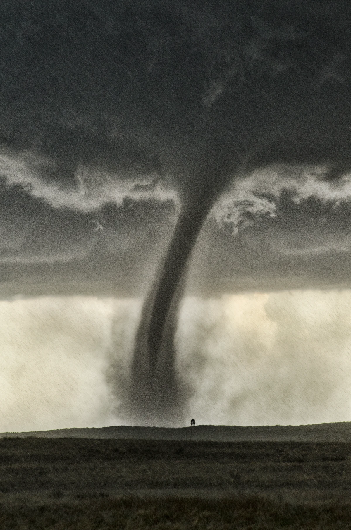
Air itself is invisible. In a tornado, falling pressure can cool the air enough for water vapour to condense into tiny droplets. These droplets make the cloud funnel visible. How far down it extends depends partly on humidity.
The air vortex may already reach the ground even if the visible funnel ends above it. Swirling dust or debris can then show rotation near the ground. If the rotating air column itself does not reach the ground, it is a funnel cloud. The length of the visible funnel alone cannot reliably distinguish the two. Rain may further obscure the view. NOAA: air vortex, condensation and ground contact.
09 / FIELD NOTE
This concerns Germany too
Tornadoes are not exclusively American. They occur in Germany too, where conditions favourable for rotating thunderstorms can develop. US case studies, however, cannot establish local frequencies or warning thresholds for the Lower Rhine.
Not all tornadoes form in supercells. Thunderstorm lines and some showers can produce them as well. In some cases, existing rotation near the ground strengthens beneath a growing updraft without a large mesocyclone forming first. The detailed explanation in this article mainly concerns supercells. DWD: tornadoes in Germany.
10 / FIELD NOTE
Germany’s tornado list: 2025 and 2026
Updated on 29 October 2026. Thomas Sävert’s German tornado list gathers observations and documents cases under review. It distinguishes confirmed tornadoes, plausible cases and suspected cases. The figures below reflect the list at the time it was checked.
2025: 46 confirmed tornadoes
For 2025, the list records 46 confirmed tornadoes, one plausible case and 92 suspected cases Together these make 139 entries, not 139 proven tornadoes. Confirmed cases include Mussum near Bocholt on 3 September, Siebersbach on 23 October and Illingen on 24 November. All three are rated F1.
View the full 2025 tornado list →
2026: 35 confirmed tornadoes so far
For the still ongoing year 2026, the list contains 35 confirmed tornadoes, one plausible case and 100 suspected cases That is 136 entries in total. The most recent confirmed case in the annual overview concerns Horrenberg and Balzfeld in Baden-Württemberg on 25 October. It is rated F1.
View the full 2026 tornado list →
A current suspected case on the Lower Rhine
The case of Twisteden near Kevelaer on 22 October 2026 is listed. Significant damage was reported in a wooded area. At the time of checking, the case was marked as suspectedThis means a tornado has not yet been confirmed.
The annual lists continue to be revised. New evidence may add entries or change classifications, even retrospectively for 2025. The totals for the completed year 2025 and the ongoing year 2026 cannot therefore be read simply as an increase or decrease. The two links lead directly to the lists for later updates.
11 / FIELD NOTE
What matters when a warning is issued
If a tornado warning is issued or a tornado approaches, seek a sturdy building in time. Go to a basement if possible, or an interior room on the lowest floor. Stay away from windows and protect your head and neck. A car, tent or open shelter does not offer reliable tornado protection. Staying outside for a photograph is a bad choice. National Weather Service: tornado safety.
12 / FIELD NOTE
Sources and update
Updated: 29 October 2026. The scientific sources are linked directly where the claims are made.
Video source: Kachelmannwetter: “How does a tornado form?” – watch on YouTube (31 May 2022).
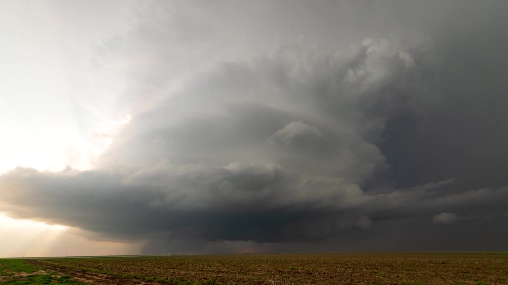
The three explanatory graphics are original schematic illustrations by The Adventure Beyond. They do not show measured data or a particular tornado event. The hero video and its still image are by BlackBoxGuild / Envato and show a supercell over the Texas Panhandle. This stock footage illustrates the article; it does not document current weather.